Lake Levels
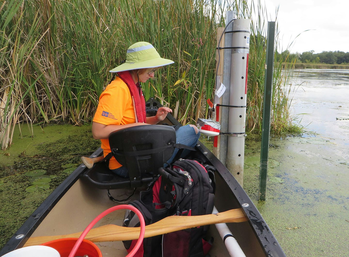
RPBCWD staff install water level sensors on all 13 lakes within the district to monitor water quantity and assess yearly historical water level fluctuations. The pressure sensors are mounted inside a protective PVC pipe attached to a post in the water or a radar is mounted to a post and deployed over the lake surface. A staff gauge is also mounted to the post to help staff determine water surface elevation.
Lake level data is used in computer modeling for stormwater and floodplain analyses and used to determine zooplankton grazing rates. The data is also shared with cities and submitted to the DNR.
Not suprisingly, precipitation has an impact on lake levels. Precipitation data from Flying Cloud Airport in Eden Prairie and the National Weather Service Station in Chanhassen is included in lake level reporting.
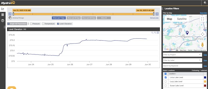
Live Data Dashboard
RPBCWD partnered with the City of Chanhassen to install live lake level sensors on four lakes: Lotus, Lucy, and Susan, and Minnewashta (outside RPBCWD). For the lakes with these sensors, data is collected every hour and uploaded to the online dashboard about every 4-8 hours. You can view the most recently uploaded data on the public lake level dashboard.
Please note that water levels of other lakes are also monitored but data is collected with different equipment and not transmitted to the lake level dashboard.
Tips for using the dashboard: To make sure you're seeing the most recent data, click "Refresh Data." Also click on "Show All" then "Show Last 7 Days" if you're not seeing recent data. For the most detailed results, select only one lake at a time when viewing the dashboard.

Slow-No Wake Restrictions During High Water Levels
RPBCWD does not make decisions about slow-no-wake restrictions on lakes during times of high water. Those decisions are determined by city staff, typically based upon their city code. For more information check out the following:
-
City of Chanhassen Lakes webpage: Includes information about the slow-no wake ordinance including a link to the city municipal code regarding slow-no wake areas (Section 6-49 Slow-No Wake Areas). To stay aware of slow-no wake restrictions, follow the City of Chanhassen on social media and visit the Chanhassen News & Updates webpage. There are three RPBCWD lakes in Chanhassen with water level elevations that trigger a slow-no wake restriction on the entire lake:
- Lotus Lake: High water is an elevation of 896.30 ft. or higher
- Lake Lucy: High water is an elevation of 957.24 ft. or higher
- Lake Susan: High water is an elevation of 882.50 ft. or higher
- City of Eden Prairie Shoreland Management Guide: Includes a link to relevant city code about slow-no wake restrictions (Section 9.60 Regulation of Use of Lake Waters Generally). Staring Lake is the only lake located in both Eden Prairie and RPBCWD that has a water elevation (817.0 ft) that triggers a slow-no wake restriction on the entire lake.
- City of Minnetonka: Ordinances regarding slow-no wake zones can be found on the Lake Minnetonka Conservation District website.
- Other cities: Reach out to city water resources or parks staff with questions about lakes.